


Masterplanning is the difference between a place that works on paper and a place that works in real life. When it’s done well, a master plan doesn’t just draw streets and buildings. It choreographs daily life — how people move, where they meet, how safely children cross the road, how the city stays cool in a heatwave, and how jobs, homes, and services stay connected as the population grows.
- What is masterplanning?
- Why masterplanning matters for smarter cities
- Core principles of great masterplanning
- The masterplanning process, step by step
- Modern tools that make masterplanning smarter
- Sustainability and resilience in masterplanning
- Real-world examples and mini case studies
- Common masterplanning mistakes (and how to avoid them)
- FAQs about masterplanning
- Conclusion: Masterplanning turns growth into long-term value
That matters more than ever. The UN projects that 68% of the world’s population will live in urban areas by 2050, adding billions more urban residents — mostly in Asia and Africa. The stakes are high: get growth wrong and you lock in congestion, sprawl, higher household costs, and emissions for decades. Get it right and you create communities that are healthy, resilient, and economically productive.
You’ll learn what masterplanning is, how it works, what “good” looks like, and how leading cities use modern planning tools — without losing the human side of place-making.
What is masterplanning?
Masterplanning is a long-range framework that coordinates land use, mobility, public space, infrastructure, environment, and development phases to shape how a city, district, campus, or community evolves over time.
A strong master plan does two things at once:
- It sets a clear vision and spatial structure (centers, corridors, neighborhoods, open space networks).
- It creates an implementable path (policies, phasing, funding, governance, and measurable targets).
Think of it as “strategy with a map” — but grounded in delivery.
Master plan vs. zoning vs. urban design: a quick comparison
| Plan type | What it answers | Typical output | Time horizon |
|---|---|---|---|
| Master plan | “What should this place become, and how do we get there?” | Vision + framework + phasing + infrastructure strategy | 10–30 years |
| Zoning / land-use regulation | “What is allowed on each parcel?” | Codes, permitted uses, FAR/height, setbacks | Ongoing |
| Urban design / public realm plan | “How should streets and spaces feel and function?” | Street sections, public space typologies, guidelines | 5–15 years |
In practice, masterplanning aligns all three so that policy and design support the same outcomes.
Why masterplanning matters for smarter cities
Urban growth is accelerating, and mistakes compound
When roads, utilities, and land use are planned in silos, cities often end up with long commutes, high infrastructure costs, and fragile service delivery. By contrast, compact and connected development can improve accessibility and affordability. World Bank research on compact-but-livable approaches highlights how better urban form and mobility integration can reduce household burdens and improve access to services.
Climate and energy pressures are now “planning problems”
Buildings and construction are deeply tied to climate outcomes. UNEP’s 2024/2025 global status report notes the sector consumes 32% of global energy and contributes 34% of global CO₂ emissions. That means masterplanning decisions — density, building performance targets, district energy, materials strategy, and mobility — are major levers for emissions reduction.
Health outcomes are shaped by spatial decisions
Access to green and blue spaces isn’t just “nice to have.” WHO and UN-Habitat resources synthesize evidence linking urban green space to health and well-being, and reference guidance commonly used in practice (such as green space accessibility and per-capita provision metrics).
Core principles of great masterplanning
Start with people, not parcels
A master plan should be anchored in daily needs: safe streets, reliable transport, local jobs, schools, health services, and parks. The “15-minute city” model popularized by Carlos Moreno reflects this shift toward proximity and access as a planning goal.
Build a legible structure: centers, corridors, neighborhoods
The most resilient urban forms are easy to understand and easy to extend. This often means:
- Mixed-use centers where activity concentrates
- Transit corridors where intensity rises
- Neighborhoods where most daily life happens
This structure helps cities grow without losing coherence.
Put mobility first (but not “cars first”)
Transport is not just movement; it’s access. Transit-oriented development (TOD) frameworks provide practical principles for aligning density, walkability, cycling, and transit so places can be productive without forcing car dependency.
Treat green-blue networks as infrastructure
Parks, tree canopies, wetlands, and waterways can cool districts, manage stormwater, and improve mental health — especially as heat risk rises. Evidence reviews and health-focused guidance emphasize measurable benefits and planning methods for valuing these spaces.
Plan for delivery: finance, governance, and phasing
A plan that can’t be implemented becomes a poster. Good masterplanning includes realistic phasing, enabling projects, and funding pathways (public capital plans, value capture, developer contributions, PPPs, etc.).
The masterplanning process, step by step
Here’s a featured-snippet-friendly definition and workflow you can reuse.
Masterplanning process (definition): A phased method to set a long-term vision for land use, movement, infrastructure, and public realm — and convert it into implementable projects, policies, and investment plans.
1) Diagnose the place (baseline + constraints)
This step typically combines spatial analysis (land use, ownership, utilities), market realities (demand, feasibility), and lived experience (safety, comfort, informal movement patterns). It also includes climate and hazard mapping, because resilience is cheaper to design in than retrofit later.
2) Define outcomes (measurable, not vague)
Instead of “a vibrant district,” use targets like:
- % of homes within a walk of daily services
- Mode share goals
- Tree canopy or green access targets
- Affordable housing share
- Jobs-to-housing balance ranges
3) Explore scenarios (and test trade-offs)
Scenario planning is where masterplanning becomes honest. Different options will shift:
- Infrastructure costs
- Housing affordability
- Travel times
- Emissions and energy demand
- Open-space availability
This is also where community engagement is most meaningful: people can react to real choices.
4) Create the spatial framework
This usually includes:
- Land use and density strategy
- Street hierarchy and block structure
- Public space network
- Mobility plan (walk/cycle/transit/freight/parking)
- Utilities and servicing concept
5) Build the implementation plan
A delivery-ready master plan identifies:
- “Early win” projects that build trust
- Phasing linked to infrastructure triggers
- Governance and approval pathway
- Funding strategy and developer requirements
- Monitoring dashboard and review cycle
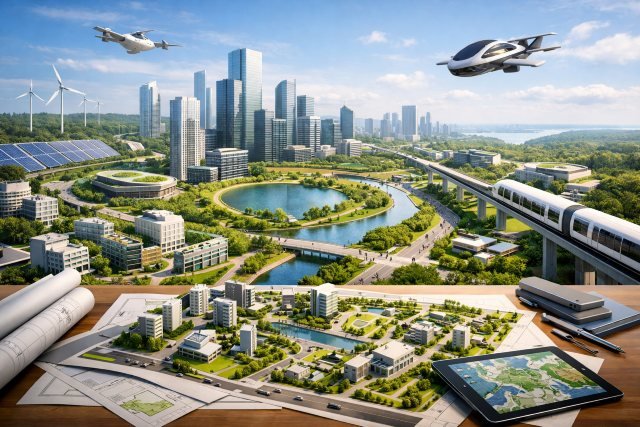
Modern tools that make masterplanning smarter
GIS + open data for evidence-based decisions
Spatial data helps you quantify access, gaps, and equity (for example, who is underserved by parks, schools, or transit). UN-Habitat’s work on public space and open/green area indicators supports this kind of measurement mindset.
Digital twins for testing “what if?”
Digital twins are increasingly used to simulate and communicate future scenarios — sunlight, wind, noise, flood risk, energy use, and mobility performance.
Helsinki describes its 3D city models as a digital twin combining IT services, open data, and continuously updating information. Singapore’s “Virtual Singapore” is positioned as a detailed 3D digital twin enabling simulations for smarter planning and innovation.
The key shift is practical: instead of debating opinions, teams can debate modeled outcomes — then validate with real-world data.
TOD standards to make transit investments pay off
TOD isn’t just “build near stations.” It’s about walkable access, mixed uses, connected street networks, and safe cycling so transit becomes the easiest choice. ITDP’s TOD Standard lays out clear principles to guide this integration.
Sustainability and resilience in masterplanning
Design for low-carbon living
Because buildings and construction are such a large slice of energy use and emissions, masterplanning should embed:
- Energy performance targets at district scale
- Passive design rules (orientation, shade, ventilation)
- Electrification readiness and renewables integration
- Low-carbon materials strategy where policy allows
UNEP’s sector figures (32% energy; 34% CO₂) help explain why planning decisions upstream matter so much.
Make heat, flooding, and water security “first-class inputs”
Resilience is no longer a specialist appendix. A smart master plan treats:
- Heat mitigation (tree canopy, cool surfaces, shade corridors)
- Floodable landscapes and retention basins
- Water demand planning and reuse opportunities
as core spatial drivers, not afterthoughts.
Equity isn’t a separate chapter
Equity shows up in:
- Who gets access to opportunity (jobs, schools, healthcare)
- Who bears pollution, noise, and heat risk
- Who can afford to stay as places improve
Practically, that means putting affordable housing near transit, prioritizing safe walking networks, and ensuring green space is distributed — not concentrated.
Real-world examples and mini case studies
Compact city strategy in practice (Toyama, Japan)
Toyama is often referenced in compact city discussions for aligning land use with transit and focusing investment where it reinforces a more efficient, livable urban form. The World Bank has published materials examining compact city development approaches and lessons from Japan, which many planners use as reference points.
The planning takeaway is simple: compactness works best when transport, zoning incentives, and public investment all pull in the same direction.
Digital twins as planning infrastructure (Helsinki + Singapore)
Helsinki’s official “Helsinki 3D” framing is important because it treats the model as an evolving city capability, not a one-time visualization. Singapore’s Virtual Singapore is similarly described as enabling simulations and innovation through a detailed 3D digital twin.
The planning takeaway: these tools are most valuable when they shorten decision cycles and make trade-offs transparent to the public.
Common masterplanning mistakes (and how to avoid them)
A plan fails quietly long before it “fails publicly.” Watch for these patterns.
Mistake 1: A beautiful map with no delivery logic
Fix: Tie phasing to infrastructure triggers and funding sources, and specify who is responsible for what.
Mistake 2: Density without livability
Fix: Treat shade, parks, schools, and street quality as non-negotiables so intensification feels good, not cramped.
Mistake 3: “Engagement theater”
Fix: Engage early, show scenario trade-offs, and close the loop by documenting what changed and why.
Mistake 4: Treating sustainability as optional
Fix: Put climate metrics into the core brief, aligned to the fact that buildings/construction are major energy and CO₂ drivers globally.
FAQs about masterplanning
What is the purpose of a master plan?
The purpose of a master plan is to coordinate growth and investment so land use, transport, public space, and infrastructure evolve together — creating a place that is functional, livable, and financially feasible over time.
How long does masterplanning take?
A typical district or community masterplan can take several months to over a year depending on data availability, stakeholder complexity, and approval pathways. The more important point is the review cycle: good plans are refreshed periodically as conditions change.
What should a master plan include?
A strong master plan usually includes a vision, spatial framework (land use + mobility + public realm), infrastructure strategy, environmental/resilience approach, development controls guidance, phasing, cost and funding logic, and monitoring metrics.
How is masterplanning different from urban design?
Masterplanning sets the long-term structure and implementation pathway; urban design focuses more on the detailed experience of streets, blocks, buildings, and public spaces.
How do you measure whether a master plan is working?
Use metrics tied to outcomes: accessibility (time to essentials), housing affordability, mode share, public space access, tree canopy/heat exposure, infrastructure performance, and delivery progress against phases.
Conclusion: Masterplanning turns growth into long-term value
Masterplanning is how cities and communities avoid “expensive chaos” and instead build places that are connected, resilient, and welcoming. With urbanization accelerating toward 2050 and the built environment playing a major role in global energy use and emissions , the masterplanning brief has expanded. It’s no longer just about land use. It’s about health, climate, equity, and delivery.
If you want a master plan that actually works, keep the focus on people and outcomes, test scenarios honestly, treat green networks and transit as foundational infrastructure, and design implementation as carefully as design intent. Done right, masterplanning becomes a practical playbook for building smarter cities and communities — one phase at a time.